
Boone is a hiker’s playground. The Blue Ridge Parkway cuts right by town. Grandfather Mountain and Elk Knob sit close enough for a half-day push. Trails range from mellow lakeside loops to laddered ridge scrambles. This guide for top hikes near Boone NC keeps it practical: what each hike is like, how far it is, where to start, and what to check before you go.
Before You Lace Up
The Parkway opens and closes by milepost due to weather and repairs. Check status the morning you hike on the Blue Ridge Parkway Road Status & Closures page. Dogs are allowed on most trails on a six-foot leash. Carry layers—wind and temps swing fast on ridges. Water levels spike after storms; creek crossings can go from playful to sketchy. In winter, bring simple traction like microspikes.
How to Use This Guide
Pick a hike for your group’s time, fitness, and comfort with exposure. Start early on weekends. Cell service is unreliable at elevation. Save offline maps or bring a printout.
The Best Hikes Near Boone NC(within ~1 hour)
Rough Ridge via the Tanawha Trail (Blue Ridge Parkway MP 302.8)
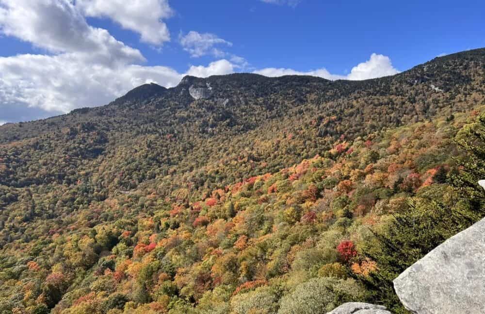
Short, steep, and wildly photogenic. Boardwalks protect fragile plants as you step onto rock slabs with big views of Grandfather Mountain and the Linn Cove Viaduct.
- Distance: 0.6–1.2 miles out and back
- Why it’s great: Huge payoff for little effort; golden hour is magic; perfect Parkway add-on
- Heads-up: Parking fills fast; stay on the boardwalk and behind cables
- Trail intel: Tanawha Trail (NPS)
Pair it with Beacon Heights (below) for a two-stop views day.
Boone Fork Loop + Hebron Falls (Julian Price Park, MP 296–297)
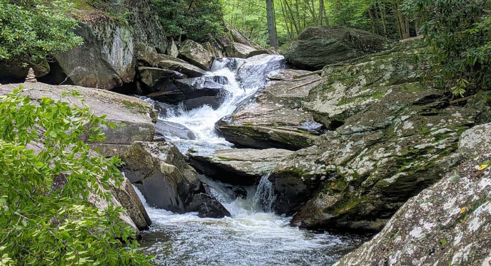
A Boone classic. Expect boulders, ladders, rhododendron tunnels, creek crossings, and a short spur to Hebron Falls (aka Boone Fork Falls).
- Distance: 5.0–5.5-mile loop
- Why it’s great: Constant variety—waterfalls, meadows, forest, rock hops
- Heads-up: Slick when wet; go clockwise for early river features
- Trail intel: Julian Price Park Trails (NPS)
Family tip: The first mile doubles as a kid-friendly TRACK Trail before the rough stuff begins.
Price Lake Loop (Julian Price Park, MP 297)
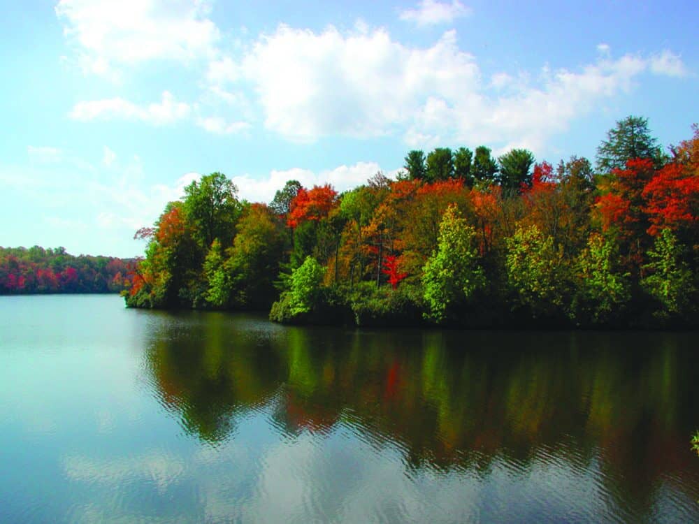
Flat shoreline walking with steady lake views. Great for sunrise or a pre-dinner stretch.
- Distance: ~2.0–2.5-mile loop
- Why it’s great: Easy, photogenic, close to town; watch for loons in shoulder seasons
- Heads-up: Roots and occasional mud
- Trail intel: Price Lake (NPS)
Flat Top Tower (Moses H. Cone Memorial Park, MP 294)
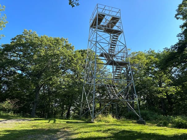
Historic carriage roads climb to a restored fire tower with 360° views. The grade is steady and the tread is wide—ideal for mixed-ability groups and muddy days.
- Distance: ~5.0–5.3 miles out and back
- Why it’s great: Big views, pastoral meadows, low-stress footing
- Heads-up: Windy at the top; yield to horses on carriage roads
- Trail intel: Moses H. Cone Trails (NPS)
Elk Knob Summit Trail (Elk Knob State Park)
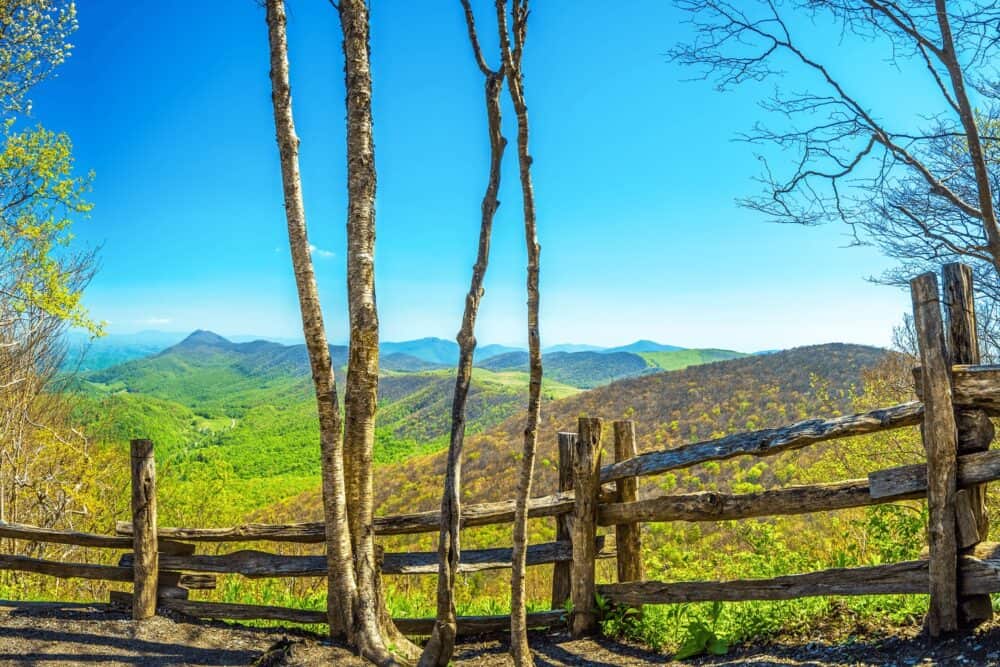
High-elevation hardwoods, stonework switchbacks, and a summit panorama that reaches into Virginia and Tennessee on clear days.
- Distance: 3.8 miles out and back
- Why it’s great: Big-view summit, well-built trail, usually calmer than Parkway hotspots
- Heads-up: Steady climb; check gate hours in winter and after storms
- Trail intel: Elk Knob State Park •
Grandfather Mountain: Profile Trail to Calloway Peak (State Park)
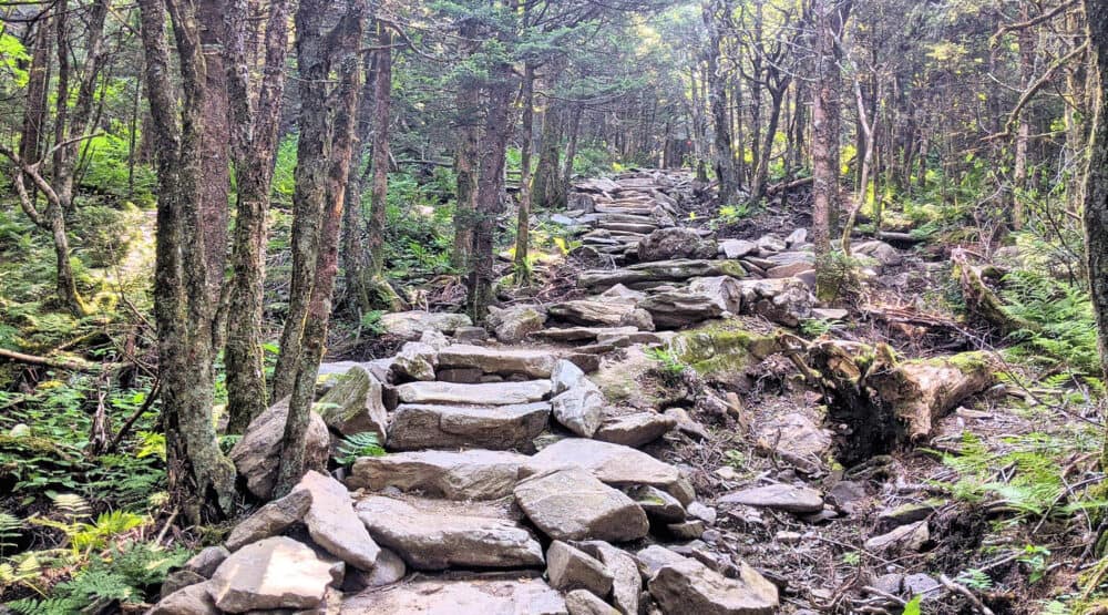
The strenuous badge of honor. The Profile climbs through hardwoods into spruce-fir with steep, rocky steps and roots. Add the ridge for ladders, cables, and exposure if your group is comfortable.
- Distance: Up to ~7.0 miles out and back to Calloway Peak
- Why it’s great: Big-mountain feel, biodiversity, and summit bragging rights
- Heads-up: Slow, technical sections; parking fills; storms hit hard on the ridge
- Trail intel: Grandfather Mountain State Park
Linville Falls (MP 316 area)
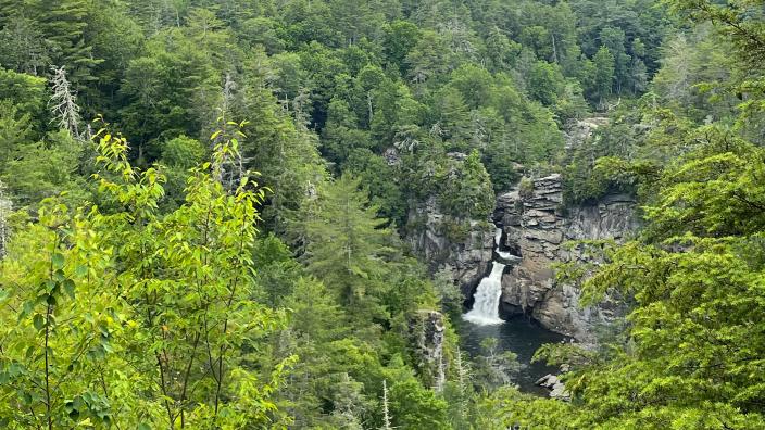
Multiple overlooks show off one of North Carolina’s most photographed waterfalls. Choose the moderate Erwin’s View side or the steeper Plunge Basin side.
- Distance: 1.6–2.0 miles total across viewpoints
- Why it’s great: Easy logistics, huge waterfall energy, family-friendly options
- Heads-up: Popular; aim for early or late; facilities vary by season
- Trail intel: Linville Falls—Trails (NPS)
The Cascades at E.B. Jeffress Park (MP 271–272)
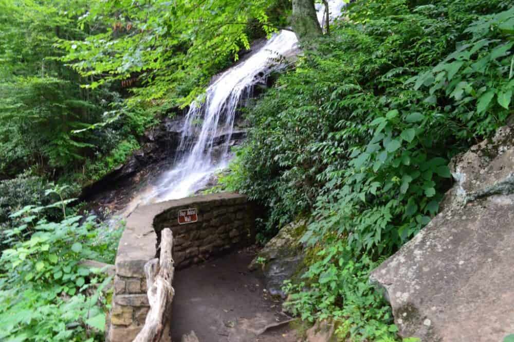
A short interpretive loop with fenced overlooks of a long, sliding cascade. Pair with a Parkway picnic or a north-of-Boone overlook crawl.
- Distance: ~1.0-mile loop
- Why it’s great: Fast leg-stretcher with safe viewpoints
- Heads-up: Stairs; slick when wet
- Trail intel: Cascades Trail (Explore Boone)
Beacon Heights (MP 305.2)
A tiny hike to open rock domes with sweeping views. It’s the logical bookend to Rough Ridge if you’re chasing light.
- Distance: ~0.6–0.9 miles out and back
- Why it’s great: Quick access to a classic sunset spot; kid-friendly with supervision on slabs
- Heads-up: Limited parking; avoid trampling fragile lichen
- Trail intel: Beacon Heights Trail (NPS)
When to go Hiking Near Boone NC
Spring: Water is high, wildflowers pop, and storms roll in fast. Expect wet trails and downed branches after weather.
Summer: Cooler than the lowlands but still humid. Afternoon thunderstorms are common; start early.
Fall: Peak color shifts by elevation from late September to late October. Trailheads fill at sunrise—midweek is your friend.
Winter: Ice forms in shade and on north-facing rock. Microspikes turn a sketchy day into a solid one. Parkway gates can close with little notice.
Practical Trail Etiquette
- Stay on marked paths and boardwalks to protect high-elevation plants.
- Keep dogs leashed; pack out all waste.
- Give wildlife room. Black bears live here; snacks go inside your pack.
- Yield to uphill hikers and to horses on carriage roads.
- Don’t swim above waterfalls or wade near drop-offs.
Suggested Half-Day Combos
- Views + Water: Rough Ridge at sunrise, then Boone Fork Loop to Hebron Falls.
- Easy Family Day: Price Lake Loop, picnic, then Beacon Heights at golden hour.
- High-Effort Day: Profile Trail to Calloway Peak; if legs remain, a quick Beacon Heights sunset.
What to Pack for Hikes Near Boone NC (and Why)
- Footing: Grippy shoes; Blue Ridge rock gets slick when wet.
- Layers: Wind shell for ridges even in July.
- Water & snacks: There’s no concession stand at milepost 300.
- Traction in winter: Microspikes save the day on ice.
- Offline map: Service drops on the Parkway. Screenshot junctions.
Internal Reads From Fit Living Lifestyle
- Hikes Near Leavenworth, WA — another “near-town” playbook worth copying.
- Southern Utah Hikes — planning patterns you can adapt anywhere.
World Traveling Blogger, Social Media Expert and Nerd who has a passion for Adventure and Fitness.