
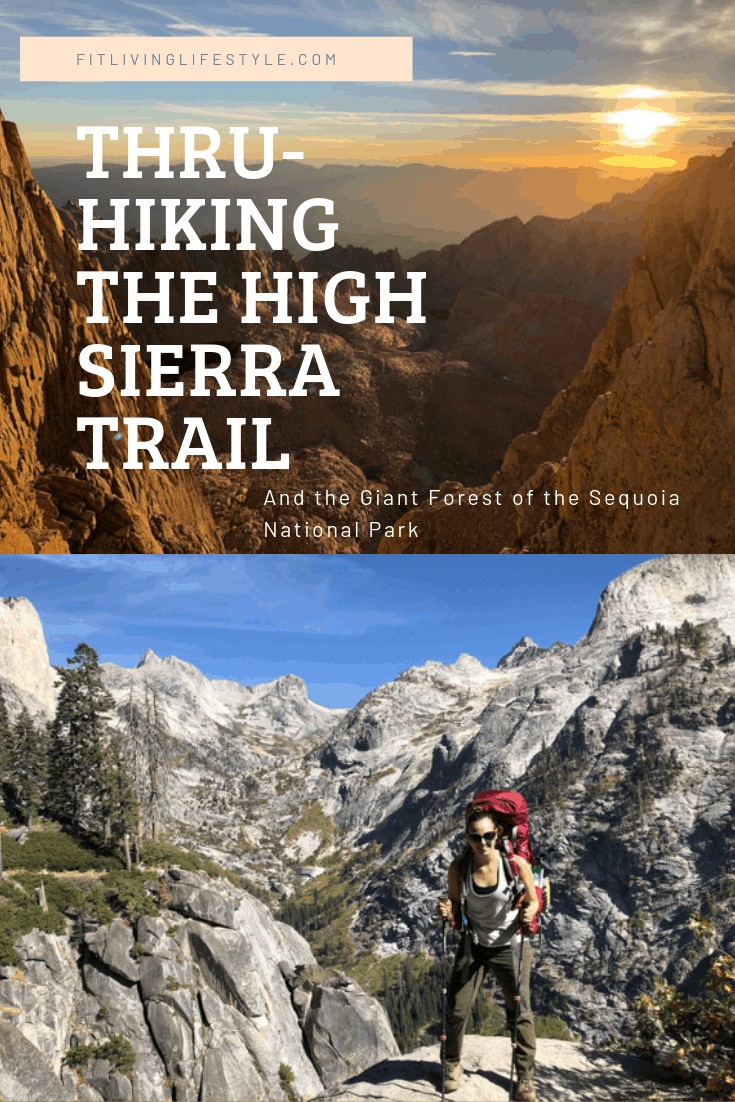
The High Sierra Trail starts in the West in the Giant Forest of the Sequoia National Park, you then hike across the mountain range to Mt. Whitney in the East and finally ending at Whitney Portal just outside of Lone Pine, CA. Mt. Whitney is the tallest mountain in the Continental US, standing at 14,505 ft.
Distance: 72 miles
Total Elevation Gain: around 19,000ft
Time: 6 to 9 days
Difficulty: Strenuous
Permits Required: Yes, from SEKI heading East or from Inyo National Forest heading West
Permits –
To hike the trail during the quota season, you email your PDF application on or after March 1 at 12:01am to the SEKI wilderness office (seki_wilderness_reservations@nps.gov). Emailed applications before that date will not be processed. It takes them a couple of weeks to get back to you because they go through all of the emails manually and award dates based on a first come first serve basis of when the emails come in. Then they will email you which dates you were awarded and a link to submit payment and you’re done with that!
Day 1 – Crescent Meadows to Panther Creek
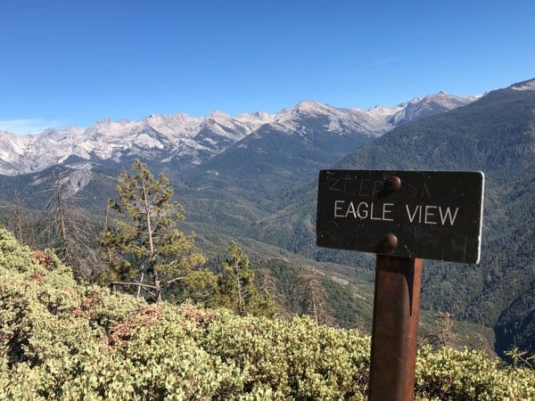
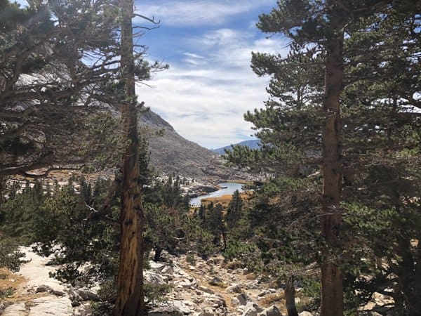
After picking up permits from the Lodgepole Visitors Center, the trail starts in the Giant Forest. About a mile in, you’ll get to Eagle View which opens up to an expansive view of the Great Western Divide which we started to ascend the next day.
Panther Creek is about 3 miles in. It’s not very well marked, look for flat ground to camp on. It’s near water so you can filter for the evening and morning.

Day 2 – Panther Creek to Hamilton Lake
Rise and shine! Today we started our ascend into and over the Great Western Divide. The first 2 miles from Panther Creek to Mehrten Creek were fairly level, but from there the trail starts to pick up in elevation gain.
At 11.5 miles into the trail, after some grueling switchbacks we arrived at Bearpaw Meadow. Brownies, beer and sample size medications such as Advil are available for sale even if you aren’t staying at the Camp’s lodging. Get the brownie, it’s an amazing treat after the last 2 mile climb. And it’s HUGE! If you want to stay at Bearpaw, you can make reservations starting January 2nd at 7am by calling (866) 807-3598.

From there it’s another steep 4 miles to get to Hamilton Lake. If you’re running low on water, fill up at Bear Paw. That’s the last chance until right before Hamilton Lake. This section of the hike is very exposed as you hike up switchbacks and the granite wall that the drops you into the bowl that Hamilton Lake sits in. There are a couple water crossings along the way and one especially larger about 1 mile from Hamilton Lake. At Hamilton Lake, you’ll encounter people who are just hiking out and back to Hamilton Lake and people who you will see throughout the rest of your journey on the High Sierra Trail. Hamilton Lake is a great place to pitch a tent for the night, or if you’re continuing further that day, it’s a great place for a break. There’s also a pit toilet just above Hamilton Lake off of the main trail.
Day 3 – Hamilton Lake to Big Arroyo Junction

Today we hiked up and over the Great Western Divide and into the Big Arroyo. From Hamilton Lake, we continued our ascend over the Great Western Divide. The hike begins with a series of switchbacks as you climb up the granite wall that overlooks Hamilton Lake. The trail gets narrow as you get to the avalanche chute known as Hamilton Gorge. There is a tunnel that was blasted out of rock that takes you around the gorge. In winter conditions, when snow is blocking the tunnel or there is ice on the trail this section of the trail is impassable unless you are equipped for winter mountaineering.

Past Hamilton Gorge, the trail continues up to Precipice Lake. This lake sits in a granite bowl at around 10,300 feet entirely fed by snowmelt. It’s the last lake in the chain that feeds into Hamilton Lake and others. Even late in September, there was some snow lingering on the cliffs that overlook Precipice Lake. Eagle Scott Peak towers above the lake and the water is a dark blue color and is very cold. At Precipice Lake you might find some flat spots to camp at, but if you’re looking to stop in that area for the night, I suggest heading up towards Kaweah Gap, there are more flat ground options there.
After Precipice Lake, we climbed the last 400 ft to the Kaweah Gap and over the Great Western Divide. And you are officially 20 miles into the High Sierra Trail! Woohoo!
From the Kaweah Gap, there is a gradual descent over the last 3 miles to the Big Arroyo Junction. This U-shaped valley was carved by glaciers as they plowed through. To the South, the valley opens up to an expansive view of the Golden Trout Wilderness. The vegetation in this area has a stunted growth because of the lack of rainfall. The Great Western Divide acts as a barrier for incoming storms and not leaving much precipitation for this valley.
Our day 3 hike on the HST was arguably the most beautiful stretch on this 72 mile journey. This section of the trail was very exposed and I suggest getting an early start to beat the heat!
There will be a sign once you get to Big Arroyo Junction. The campsites are more South and off the trail. Keep walking straight and you will see an old wooden ranger cabin, set up camp near there. There is easy access to the river to fill up water, wade in, and wash your clothes in. You will also see a communal bear box in that area.
Day 4 – Big Arroyo Junction to Kern Hot Spring

We woke up chilly to frozen socks (I had an extra pair that did not freeze) and frozen shoes. I brought toe warmers with me and did jumping jacks to warm up while making breakfast and packing up. Once I started hiking, I warmed up about a mile in. I did not expect that night at Big Arroyo to get that cold and for it to freeze, especially since the previous two nights had been so pleasant. But that’s the thing about these mountains, you just never know.
Once we left camp, the trail continues uphill for the first 3 miles with 1,000 ft of elevation gain. There were not many water options along this stretch, so if you’re worried about running out, I suggest filling up at Big Arroyo before leaving. Once you reach the Chagoopa Plateau, the trail levels out for a couple of miles.
At around 7 miles into the day, you’ll see a right-hand trail that branches off to Moraine Lake. This adds another mile to the hike, but if you’re looking to fish, we heard from fellow HST hikers that they caught a good amount of dinner there. You can camp at Moraine Lake and there are bear boxes and you can have a fire there. We were exhausted and didn’t want to add more miles to the day so we skipped it.
Past the Moraine Lake junction, the trail starts to descends around 400 ft in elevation gradually over 2 miles. A fire rolled through parts of today’s section leaving the forest a mess with dead trees standing or fallen littering the forest floor with new vegetation growing around it.
At 9 miles the descent gets steeper as you drop 2,400 ft in elevation in 4 miles and hike down a series of rocky switchbacks to where the trail meets the Kern River Valley. This part sucks. I hate to say it, but it was honestly the worst part of the hike. By this point, my knees were hurting and I just wanted to get down to camp.
We were originally planning to camp at Upper Funston Meadow, which we thought was right at the bottom of the switchbacks, but nope. Once we got to the bottom, we saw there is nowhere to even pitch a tent. Upper Funston Meadow is less than a mile off of the HST. Once you reach the bottom, turn right to get to Upper Funston Meadow and turn left to continue on the HST to Kern Hot Springs. We were exhausted and the last thing we wanted to do was hike more in the wrong direction. So we pressed forward to Kern Hot Springs. The campground is a little further up on the trail past the actual hot springs, there are bear boxes, a pit toilet and they do allow fires.
Day 5 – Kern Hot Spring to Junction Meadow
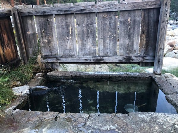
This was the easiest day of the whole hike. The hot springs basically renewed us. They were AMAZING! There is a concrete bathtub built to collect the hot spring water. You can even drain it and then refill it to have fresher water. There is a wooden fence around the concrete tub to give you some privacy and there is a metal pot that you can use to pour the warm water on your head. Before getting in, wipe off any sunscreen and bug spray to protect the ecosystem and to preserve the experience for other hikers.
The water crossings in this section were the most difficult so far. And although this is the easiest section of the whole hike, I suggest getting an early start to the day. The trail is very exposed and it can get hot in the Kern River Valley.
On the map, Junction Meadow is further up on the trail from the campsite. Right before, you’ll do a big water crossing and right on the other side of it, you’ll see a flat area and a campground. Congratulations, you’ve made it to the Junction Meadow campground and mile 45 of the HST!

When we arrived, we were the first ones and were confused if we were in the right spot. But it was close, we saw bear boxes and fire rings so we set up camp. An hour later the other groups we had been leap-frogging with started to stroll in.
We had an early dinner and I wadded in the river that runs by camp and had an early night.
>Hiking The Rice Terraces of Banaue<
Day 6 – Junction Meadow to Guitar Lake
The first 4 miles of the trail once you leave camp at Junction meadow gain 2,400 ft and are exposed. I wanted to get past the hardest part of the day in the dark and while it was still cool out.
Unfortunately, my group didn’t want to start hiking at 4am, but I rallied someone from a different group who we had been leap-frogging with throughout the HST hike and was also camping at Junction Meadow. He agreed to get up early and hike at 4am with me so I wouldn’t have to go at it solo. We had a waning gibbous moon that helped with visibility and our headlamps. Although I’m sure I missed some stunning views as we climbed out of the Kern Canyon, we experienced some of it under a bright not-so full moon. There is limited water on this stretch up the switchbacks. When sunrise started, we had just made it to the top of the switchbacks and watched it rise over the Great Western Divide and the Kaweah Peaks we hiked over a few days ago to the West.

Wallace Creek is where the HST meets the PCT and the JMT, from there you all continue to Guitar Lake (or Crabtree Meadow) before summiting Mt. Whitney the next day. There are campsites at Wallace Creek and bear boxes, but no fires are allowed. Wallace Creek sits at 10,400 ft and from here on, until your descent to Whitney Portal, you will not be below 10,000 ft. Being at this elevation is great to acclimate for the push to Mt. Whitney at 14,505 tomorrow.
The vegetation continues to change, the heavy forests we saw, in the beginning, ended after going over Kaweah Gap a few days ago, are long gone. In the 5 mile stretch to Crabtree, the trail continually goes up a few hundred feet and then descends a few hundred feet. You can camp at Crabtree, but we decided to push on the last 2 miles to Guitar Lake because we wanted to save those 2 miles in the morning and to acclimate at a higher elevation.
If you did not pick up your WAG Bags at Lodgepole or the Whitney Ranger Station before leaving, pick them up at Crabtree. You are now in the Mt. Whitney Zone and all human waste needs to be packed out in a WAG Bag. Do not bury it and leave it here. Also, for the entire trail, all TP and other trash need to be packed out. Follow Leave No Trace Principles.
From Crabtree, it’s a 2 mile push to Guitar Lake. There is minimal water available on this stretch too.
We finally made it to Guitar Lake, it’s really shaped like a Guitar. I filled up water, soaked my feet, set up camp and prepared myself for the summit hike tomorrow.
We saw the most amazing sunset of the entire trip. Our camp lit up in pink tones and so did the peaks around us. Unfortunately, from the trail both from the West and the East, you can’t see Mt. Whitney. She hides behind other peaks.
Day 7 – Guitar Lake to Mt. Whitney summit to Whitney Portal

Final day on the HST!! You made it!! We made it! It’s an amazing feeling and it’s really been quite an amazing journey. I had a heavy pack on (45lbs, I know, don’t carry this much weight, way too heavy). But even with that, turning around was never an option, I wanted to make it and even through the tears and body aches, I tried to keep mentally strong and pushed through.
We got up at 12:30am, packed up, filled up our waters because this is the last water source for around 10 miles until you reach the first campsite on the Eastern side of Mt. Whitney, Trail Camp which sits at 12,000 ft below 97 switchbacks (no joke, they’ve been counted).

Under a well lit moon, we started hiking the 3,105 ft out of Guitar Lake and to the Mt. Whitney Summit. The first 3 miles you go up switchbacks that spit you out at Trail Crest at 13,645 ft. We almost didn’t even need headlamps the moon was so bright.
I took it nice and slow not to get altitude sickness. Finally, around 5am, I reached Trail Crest. Trail Crest is where the trail from the West meets the trail from the East. Then there is a 2 mile out-and-back trail that leads to the Mt. Whitney summit. If you are feeling altitude sickness, don’t continue on to Mt. Whitney, head down the mountain from Trail Crest.

I summited Mt. Whitney at 7am because I was taking it nice and slow not to get altitude sickness. Then from the top, I ran down to get my pack at Trail Crest and descended down the 97 switchbacks. Yes, they suck as much as everyone says they do. My knees were hurting by the time I made it down to 12,000 ft at Trail Camp.

Then I hiked all the way out to Whitney Portal and made it back to my car at 7pm. It was such a joy to see my little red car at the end of the trail waiting for me. I finally took off my pack, put on UGGs and was able to call my family to tell them I made it! I drove to town, got a pizza which I could only eat one slice even though I wanted to eat the whole pizza, split a hotel room with the badass ladies I shared this experience with, showered, and slept for 12 hours.
The next day, I woke up and saw Mt. Whitney and it was an amazing feeling knowing that I hiked down from that.
Thank you for reading through my High Sierra Trail post. It was honestly one of the hardest yet more rewarding things I’ve ever done! If you want to read more articles from me, head over to CampsiteVibes.com!
I didn’t grow up living the outdoor lifestyle I do now. Prior to 2014, I had never slept in a tent, hiked more than a mile or two, or peed behind a tree. But we all start somewhere! Since then I’ve learned quite a bit about what it takes to hike cross country trails and to summit 14’er peaks, and I want to share that knowledge. To help you get past your limitations and fears, help you understand how to train and help give you the knowledge to get out there and hike. It’s a beautiful planet, you deserve to see it for yourself, not just on Instagram.