
Bath may be famous for its Roman baths, honey-coloured Georgian terraces and elegant architecture, but some of southwest England’s loveliest walking countryside begins just beyond the city streets. The best scenic walks near Bath take you from panoramic hilltops and peaceful river valleys to ancient villages, historic aqueducts and quiet stretches of the Cotswolds.
Even better, you don’t need to be an experienced hiker to enjoy them. There are gentle canal walks, short viewpoint trails and longer countryside loops for days when you want to stretch your legs. Some start right in central Bath, making it easy to swap a busy sightseeing afternoon for a little fresh air.
We’ve rounded up 11 beautiful walks in and around Bath, England, with route distances, estimated walking times, difficulty levels, starting points and practical advice to help you choose the right one. Each recommendation links to a published route guide, so you can check the directions before setting off.
Quick recommendation: Choose the full Bath Skyline for classic city views, Little Solsbury Hill for a rewarding climb, Bradford-on-Avon to Avoncliff for waterside scenery, or Castle Combe for a postcard-perfect countryside walk.
Best Walks Near Bath at a Glance
Use this comparison table to find a route that suits your schedule and fitness level. The walking times are guides rather than guarantees; allow longer for photography, rest breaks, muddy conditions or café stops.
| Walk | Distance | Time | Difficulty | Best for |
|---|---|---|---|---|
| Bath Skyline Walk | 6 mi / 9.6 km circular | 3.5–4 hrs | Moderate | Classic Bath panoramas |
| Walk to the View | 3 mi / 4.8 km circular | 1.5 hrs | Easy | Views from the city centre |
| Little Solsbury Hill | 3 mi / 4.9 km circular | 1 hr 50 mins–2 hrs | Easy–moderate | Hilltop views and history |
| Kelston Roundhill | 3 mi / 4.8 km circular | 2–2.25 hrs | Moderate | Wide countryside views |
| Two Tunnels Greenway | 3.8 mi / 6.1 km one way | 1.5–2 hrs one way | Easy | Unusual railway scenery |
| Bradford-on-Avon to Avoncliff | 3 mi / 4.8 km return | 2 hrs | Easy | Canals, river and aqueduct |
| Dundas Aqueduct | 0.5 mi / 0.8 km return | 30–60 mins | Easy | Short family-friendly outing |
| Castle Combe and Long Dean | 5 mi / 8.1 km circular | 2 hrs 40 mins | Easy–moderate | Cotswold villages and woodland |
| Dyrham Park Prospect Walk | 3 mi / 4.8 km one way | 1–1.5 hrs | Easy, uneven sections | Parkland and historic estate |
| Prior Park Water Walk | 0.8 mi / 1.3 km one way | 27–30 mins | Easy, some hills | Walk to a landscaped garden |
| Southstoke and Cam Brook Valley | 5.5 mi / 8.9 km circular | 3 hrs 10 mins | Easy–moderate | Quiet Somerset countryside |
The 11 Most Beautiful Walks Near Bath
1. Bath Skyline Walk – Best Overall Walk for Spectacular City Views
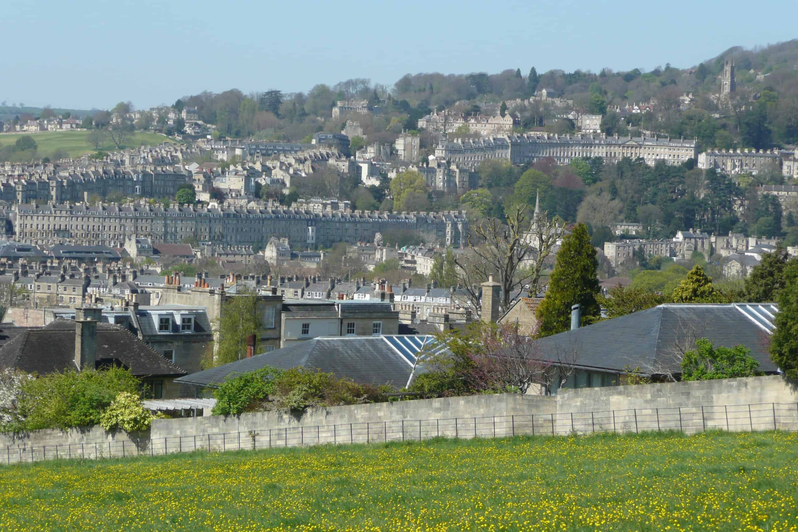
Distance: 6 miles (9.6 km), circular
Walking time: 3 hours 30 minutes–4 hours
Difficulty: Moderate
Starting point: Bathwick Hill at Cleveland Walk, Bath, BA2 6JP (OS grid ST76046 64704)
Best for: Panoramic viewpoints, woodland and a proper half-day walk
If you only have time for one countryside walk in Bath, the Bath Skyline Walk is an excellent choice. Within a relatively short distance of the city centre, you can leave behind the traffic and Georgian buildings and find yourself walking through open meadows, peaceful woodland and elevated paths overlooking Bath.
The changing perspective is what makes this route special. One moment you’re surrounded by trees, and the next the landscape opens up to reveal a patchwork of rooftops and green hills. Bath’s famous golden buildings look particularly striking against the surrounding countryside, especially when the late-afternoon sun catches the stone.
Highlights include Bathwick Fields, woodland paths and viewpoints around the eastern edge of the city. There’s enough variation underfoot to make the walk feel like a real countryside escape rather than simply a stroll between viewpoints.
Practical tips: The National Trust recommends completing the marked circular route clockwise. Expect steep hills, steps, a stile and some rocky or uneven paths. Wear supportive walking shoes, carry water and check the map carefully at junctions. There’s no dedicated National Trust parking area at the trail start, so walking or using local public transport is often the easiest option.
Official route: National Trust Bath Skyline walking directions and map.
2. Walk to the View – Best Easy Scenic Walk from Central Bath
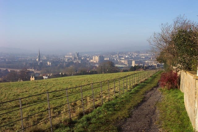
Distance: 3 miles (4.8 km), circular
Walking time: 1 hour 30 minutes
Difficulty: Easy, with one notable uphill section
Starting point: Bath Abbey, Kingston Parade, Bath, BA1 1LT
Best for: Visitors without a car, families and shorter walks
Not everyone wants to spend four hours climbing around Bath’s surrounding hills. Fortunately, the National Trust’s Walk to the View provides a shorter alternative that still delivers a wonderful mix of architecture, waterways and countryside scenery.
Beginning beside Bath Abbey, the walk introduces you to the city’s elegant streets before leading towards Bathwick and the greener landscapes above town. It’s a satisfying transition from historic urban Bath to open space, with attractive views back across the rooftops.
This is a particularly good option for travellers staying in the city centre. You can finish your morning sightseeing, take a scenic walk and return in time for a late lunch without needing a car or committing to an all-day hike.
Practical tips: Although officially rated easy, the route includes an ascent at Bathwick Hill and some field paths. Allow extra time if you’re walking with younger children. Watch for traffic on the city sections, and keep dogs under close control around livestock. This short route overlaps with parts of the wider Bath Skyline landscape but is a separate, published circular itinerary.
Official route: National Trust Walk to the View.
3. Little Solsbury Hill – Best Hilltop Walk for Panoramic Views
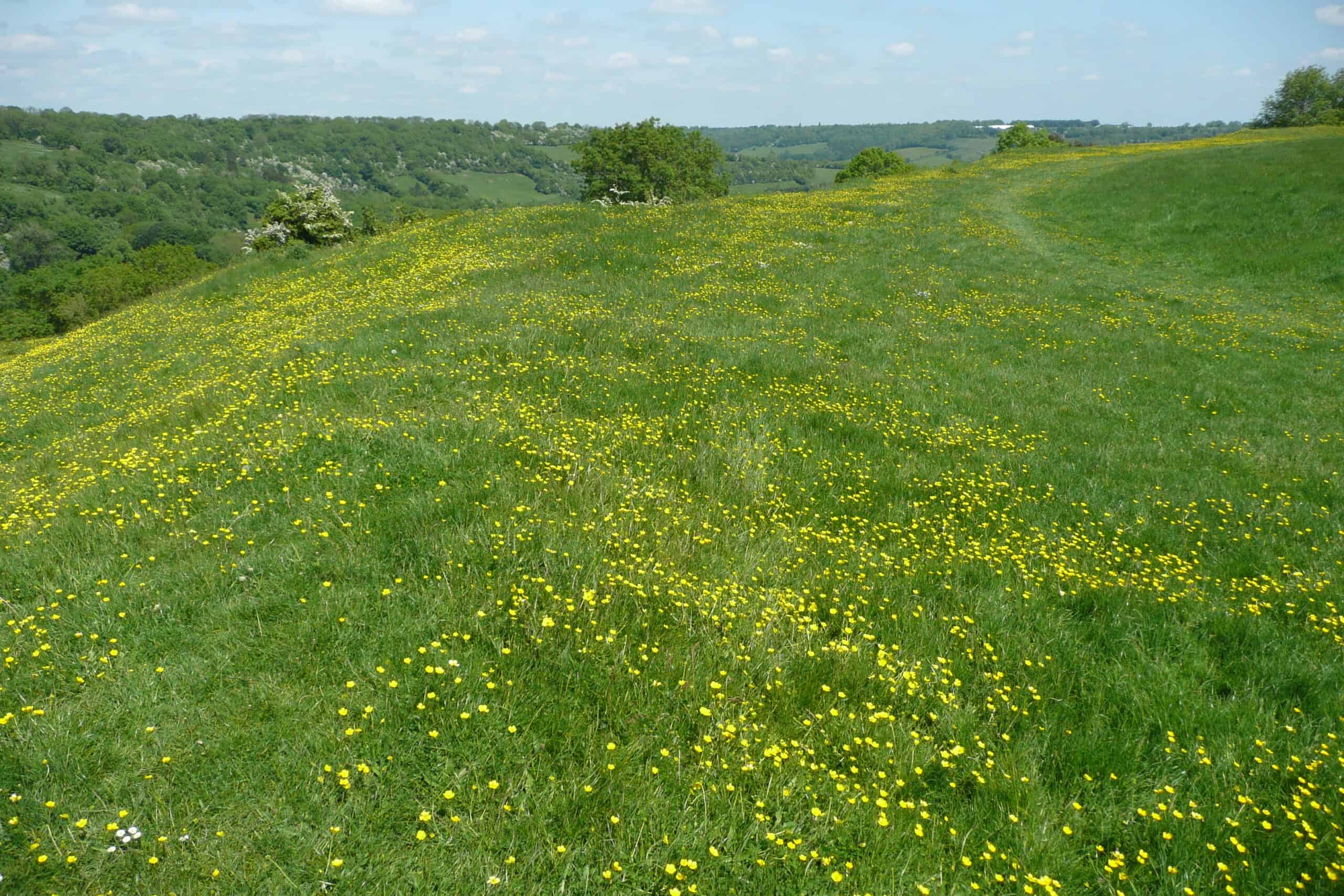
Distance: 3 miles (4.9 km), circular
Walking time: Approximately 1 hour 50 minutes–2 hours
Difficulty: Easy–moderate, with around 152 metres of ascent
Starting point: Northend village, near Seven Acres Lane, Bath (OS grid ST779682)
Best for: Hilltop views, ancient history and photography
There’s something wonderfully satisfying about reaching a hilltop and seeing the landscape spread out in every direction. Little Solsbury Hill, northeast of Bath, rewards walkers with views across the Avon Valley and the city’s surrounding countryside.
The hill is also steeped in history. Its summit was once occupied by an Iron Age hillfort, and traces of the old earthwork defences can still be seen. Unlike a conventional sightseeing attraction, the appeal here is the open landscape itself: grassy slopes, changing light and the sense of standing above the bustle of Bath.
The circular route from Northend follows lanes and countryside paths through Chilcombe Bottom before climbing towards the summit area. The walking is relatively straightforward, although the uphill sections provide enough exercise to make the expansive views feel well earned.
Practical tips: There’s limited roadside parking in Northend, so be considerate of residents and avoid blocking access. The route includes stiles, fields and a noticeable climb. Solsbury Hill is exposed to the wind, making an extra layer useful even when Bath feels mild. After rain, expect muddy ground.
Detailed route: Walking Britain: Little Solsbury Hill from Northend.
4. Kelston Roundhill – Best Countryside Walk for Wide-Open Views
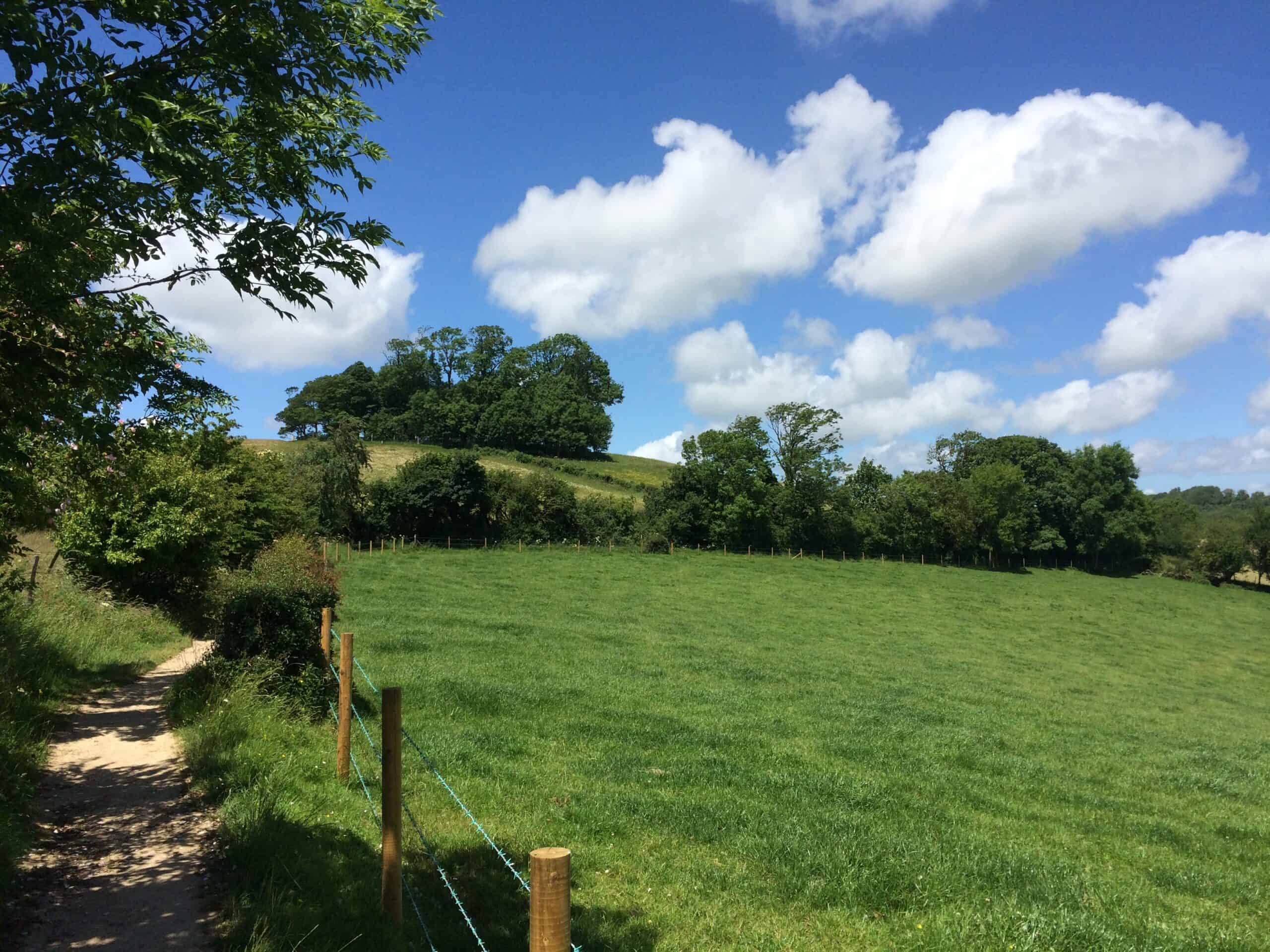
Distance: 3 miles (4.8 km), circular
Walking time: Approximately 2–2 hours 15 minutes
Difficulty: Moderate, with uphill sections
Starting point: Kelston village, near the A431 (OS grid ST699670)
Best for: Rolling hills, countryside views and a peaceful rural atmosphere
West of Bath, the rounded summit of Kelston Roundhill is one of those landmarks that seems to beckon you uphill. From a distance it looks deceptively gentle, but its elevated position offers a surprisingly far-reaching panorama over the countryside.
A circular walk from Kelston village follows farmland and hillside paths towards the distinctive summit. Along the way, you’ll experience classic English countryside: green fields, hedgerows, old farm tracks and views that become increasingly impressive as you gain height.
On a clear day, the outlook stretches well beyond Bath towards Bristol and the hills of South Wales. It’s a beautiful place to slow down, take a few photographs and appreciate just how green this part of England really is.
Practical tips: This is a better choice for walkers comfortable with hills rather than anyone looking for a completely flat stroll. Follow the designated public rights of way and permissive paths; the summit area isn’t an invitation to cross private fields wherever you please. Parking in Kelston is limited, and visitors should avoid parking in Cullimore’s Lane. Keep dogs under close control around farm animals.
Published route: Cotswolds National Landscape: Kelston Roundhill ascent.
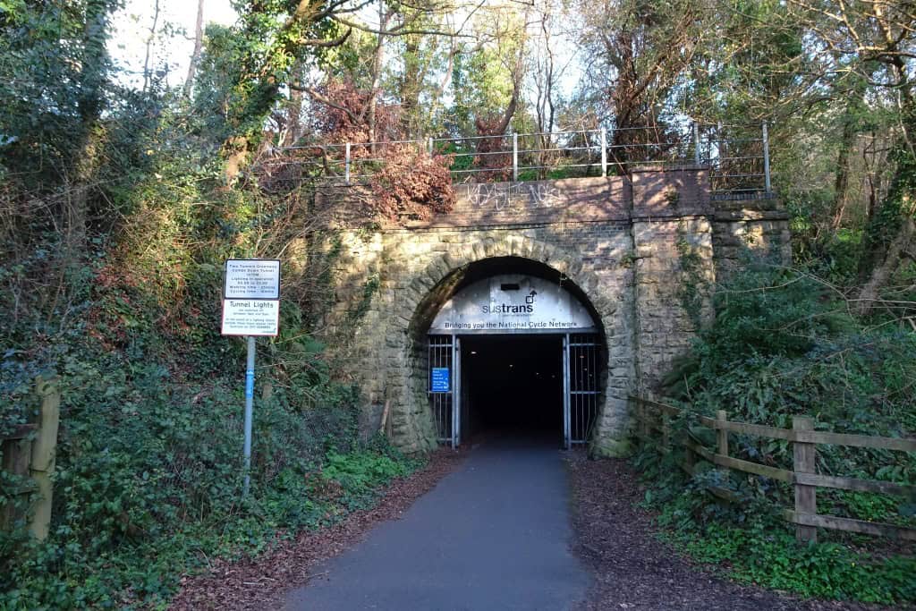
5. Two Tunnels Greenway – Most Unusual Scenic Walk Near Bath
Distance: 3.8 miles (6.1 km), one way
Walking time: Approximately 1 hour 30 minutes–2 hours one way
Difficulty: Easy, mostly level and paved
Starting point: East Twerton, Bath, near the National Cycle Network Route 244 access
Finish: Midford, south of Bath
Best for: Railway history, an unusual adventure and relatively level walking
Not every beautiful walk involves a mountain, hilltop or riverbank. Sometimes the adventure comes from heading underground.
The Two Tunnels Greenway follows a former railway corridor through the hills south of Bath. The route includes the atmospheric Devonshire and Combe Down tunnels, with the latter extending for more than a mile beneath the landscape.
Walking into the cool, dimly lit tunnel feels like entering another world. The sounds of the city disappear, and the old railway alignment creates a strikingly different experience from the more traditional countryside paths around Bath.
Outside the tunnels, you’ll discover wooded cuttings, glimpses into Lyncombe Vale and attractive rural scenery as the route heads towards Midford. It’s a particularly enjoyable choice if you like walks with an interesting story behind them.
Practical tips: The published 3.8-mile route is one way, not a circular walk. Returning on foot along the same route brings the total to approximately 7.6 miles (12.2 km). Plan your return transport before starting if you don’t want to walk back. The greenway is shared with cyclists, so stay alert, especially inside the tunnels. Bring a light layer because the tunnel interiors can feel chilly even in summer.
Official route: Walk Wheel Cycle Trust: Route 244, Two Tunnels Greenway. For access information, see Two Tunnels Greenway directions.
6. Bradford-on-Avon to Avoncliff Aqueduct – Best Riverside and Canal Walk
Distance: 3 miles (4.8 km), return
Walking time: Approximately 2 hours
Difficulty: Easy, with a short descent and ascent
Starting point: Bradford-on-Avon railway station car park, Pound Lane, BA15 1LF
Best for: Waterside scenery, historic architecture and a walk accessible by train
If your ideal scenic walk involves gently moving water, charming historic buildings and the possibility of a pub stop, the route from Bradford-on-Avon to Avoncliff is hard to beat.
Bradford-on-Avon is a delightful town in its own right, with old stone buildings, narrow streets and the magnificent medieval Tithe Barn. From the station area, this walk takes you through the historic Barton Farm surroundings and alongside the River Avon before joining the Kennet and Avon Canal.
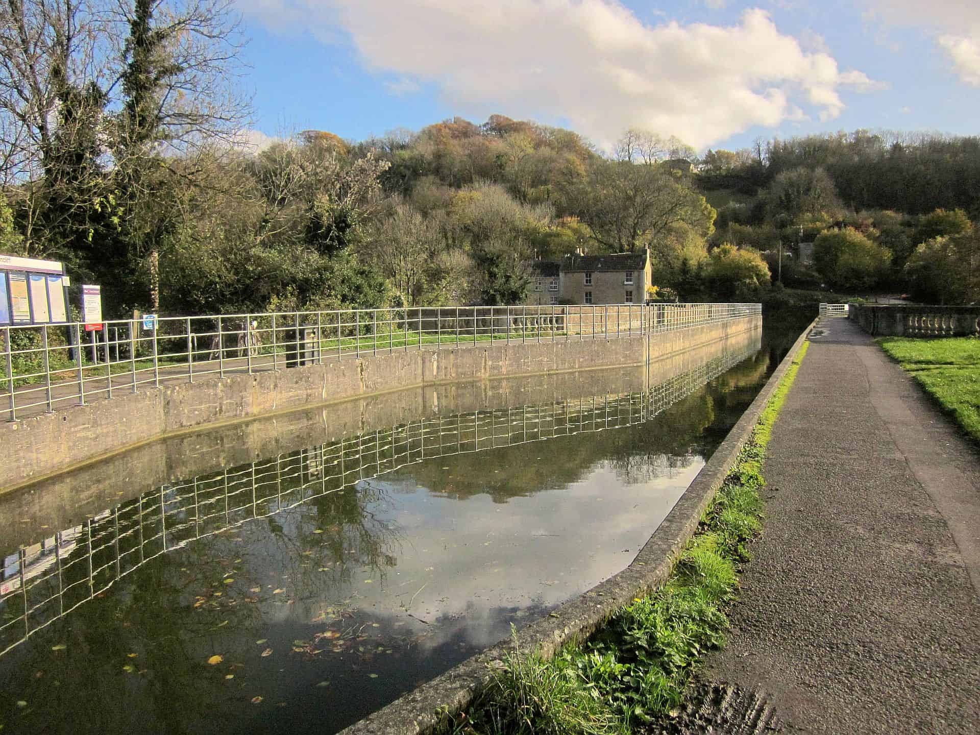
The highlight is Avoncliff Aqueduct, where the canal crosses high above the River Avon. Watching narrowboats glide across a stone aqueduct while the river flows below is a lovely reminder of Britain’s remarkable canal-building history.
There are attractive places to pause around Avoncliff, making this one of the most relaxing walks on our list. On a sunny day, the reflections on the canal and the surrounding green landscape are especially beautiful.
Practical tips: Bradford-on-Avon is reachable by train from Bath, so this is a good car-free outing. The published route is around three miles in total, returning along the same waterside corridor. Most surfaces are firm, but there is a short steep descent near the start and a climb to reach the towpath. Canal paths can become slippery or muddy after heavy rain. Allow extra time to explore the town.
Published route: Cotswolds National Landscape: Bradford-on-Avon to Avoncliff.
7. Dundas Aqueduct – Best Short and Easy Walk Near Bath

Distance: 0.5 miles (0.8 km), return; approximately 0.75 miles (1.2 km) with the Coal Canal extension
Walking time: 30–60 minutes at a relaxed pace
Difficulty: Easy
Starting point: Dundas Marina / Brassknocker Basin, near Monkton Combe, BA2 7JD
Best for: A gentle waterside stroll, families and visitors short on time
Sometimes you don’t need a long hike to see somewhere memorable. Dundas Aqueduct, southeast of Bath, offers beautiful canal scenery and an impressive historic structure within an easy, short walk.
The aqueduct carries the Kennet and Avon Canal above the River Avon and railway, creating a remarkable meeting of water, engineering and countryside. The surrounding area is peaceful and attractive, with moored narrowboats, leafy banks and lovely views along the water.
Starting near Dundas Marina, a gently rising path leads towards the aqueduct. You can cross it, enjoy the views and return the same way, or continue on a short extension beside the old Somersetshire Coal Canal.
It’s a particularly appealing choice for a slower day when you want to enjoy the outdoors without committing several hours. Bring a coffee, take your time and watch the canal boats pass.
Practical tips: The main approach has a gentle gradient and largely firm surfaces. The longer extension uses canal towpaths, which may be rougher or muddy in places. Parking is available at Dundas Marina on a pay-and-display basis; check current arrangements on arrival. Keep children close beside the open water and check café opening times rather than relying on refreshments being available.
Published route: Cotswolds National Landscape: Dundas Walks on Wheels. More information: Canal & River Trust: Dundas Aqueduct.
8. Castle Combe and Long Dean – Best Cotswold Village Walk

Distance: 5 miles (8.1 km), circular
Walking time: Approximately 2 hours 40 minutes
Difficulty: Easy–moderate, with uneven countryside paths
Starting point: Castle Combe visitors’ car park above the village (OS grid ST845777)
Best for: Storybook villages, woodland, historic buildings and photography
Castle Combe looks like the sort of place you’d expect to find on a calendar of beautiful English villages. Honey-coloured cottages line narrow streets, a small stone bridge crosses the water, and the surrounding wooded valley gives the whole village an almost timeless atmosphere.
But as lovely as the village is, there’s much more to enjoy beyond its famous bridge. The five-mile Castle Combe and Long Dean circular walk explores surrounding farmland, quiet lanes, wooded paths and the Bybrook Valley before returning to the historic village.
One of the nicest things about this walk is the contrast between scenery. You move through open fields and enclosed woodland, then arrive back among old stone cottages that feel almost unchanged by modern life. It makes a lovely half-day excursion from Bath, especially if you enjoy pairing walking with a little village exploration.
Practical tips: Start from the designated visitors’ car park above Castle Combe rather than trying to squeeze into the village’s narrow streets. Parts of the route cross farmland and can become muddy. The walk also includes some road and lane sections, so take care around traffic. Arriving early is worthwhile during weekends and holidays when the village attracts plenty of visitors.
Detailed route: Walking Britain: Castle Combe and Long Dean Circular.
9. Dyrham Park Prospect Walk – Best Historic Estate and Parkland Walk

Distance: 3 miles (4.8 km), published route from visitor reception to the house
Walking time: Approximately 1 hour at the published pace; allow 1–1.5 hours with stops
Difficulty: Easy overall, with some steep and uneven ground
Starting point: Dyrham Park visitor reception, SN14 8HY
Best for: Expansive parkland, countryside viewpoints and historic estates
If you like your scenic walks with a little history, Dyrham Park is a wonderful place to explore. Set in the Cotswold countryside north of Bath, this National Trust estate combines open parkland, mature trees, rolling hills and a grand historic house.
The Prospect Walk is designed to showcase some of the estate’s finest views. On clear days, you can look across the surrounding hills towards distant landscapes before descending through the grounds towards the elegant East Front of Dyrham’s house.
Unlike a busy urban park, Dyrham has the space to feel genuinely rural. The broad lawns, graceful trees and undulating land make it an attractive place to walk in every season. Autumn can be especially beautiful when the trees change colour, although the open landscape is equally lovely under blue summer skies.
Practical tips: This walk takes place within a National Trust property, so check admission prices, opening hours and parking arrangements before visiting. The published trail finishes near the house rather than returning automatically to your starting point, so allow for the additional journey back. Some parkland paths are uneven or steep, and normal pet dogs are not permitted on this route; assistance dogs are welcome. There are no direct public transport links from Bath to the estate according to the National Trust.
Official route: National Trust: The Prospect Walk at Dyrham Park.
10. Prior Park Water Walk – Best Short Walk to a Beautiful Landscape Garden

Distance: 0.8 miles (1.3 km), one way to the garden entrance
Walking time: Approximately 27–30 minutes to the entrance
Difficulty: Easy, although some sections are hilly
Starting point: Bath Spa railway station, Dorchester Street, BA1 1SU
Best for: A short scenic outing combined with a visit to Prior Park
For somewhere that feels both elegant and peaceful, Prior Park Landscape Garden is one of Bath’s most appealing green spaces. Its famous Palladian Bridge, ornamental lake and surrounding wooded hills create a scene that feels wonderfully removed from the busy city streets.
The National Trust’s short Water Walk begins at Bath Spa railway station and leads towards the garden’s lower entrance. It’s a convenient choice for visitors arriving by train who want to add some greenery to their Bath itinerary.
Once inside the landscape garden, you can enjoy the sweeping valley setting and admire the Palladian Bridge reflected in the water. The combination of landscaped grounds, graceful architecture and mature trees makes Prior Park an especially rewarding place for photography.
Important distinction: The published 0.8-mile Water Walk takes you to the garden entrance. It does not include a walk around the gardens or across the Palladian Bridge. You’ll need admission to enter Prior Park, and you should allow additional time for exploring the grounds and returning to the city.
Practical tips: Check Prior Park’s opening times and admission information before setting out. There is no visitor car park at the garden, which makes this train-station approach particularly useful. Expect some slopes and road sections, and wear shoes suitable for garden paths if you plan to explore beyond the entrance.
Official route: National Trust: The Water Walk from Bath Spa to Prior Park.
11. Southstoke and Cam Brook Valley – Best Peaceful Countryside Walk

Distance: 5.5 miles (8.9 km), circular
Walking time: Approximately 3 hours 10 minutes
Difficulty: Easy–moderate, with around 197 metres of ascent
Starting point: Village green, Southstoke, Bath, BA2 7DN (OS grid ST747613)
Best for: Quiet paths, green valleys, woodland and traditional Somerset villages
While some scenic walks near Bath attract a steady stream of visitors, Southstoke and the Cam Brook Valley offer a quieter kind of countryside experience. This is the walk to choose when you’re less interested in ticking off famous landmarks and more interested in simply enjoying the landscape.
Southstoke itself is a charming village with traditional Bath-stone cottages and a peaceful rural atmosphere. From the village green, the circular walk follows field paths, tracks and woodland before descending towards the Cam Brook Valley.
The scenery unfolds gradually rather than offering one dramatic viewpoint. Expect rolling fields, wooded stretches, old lanes and lovely views of the countryside south of Bath. It’s the kind of route where birdsong, rustling leaves and the occasional distant farm sound become part of the experience.
Because the route is longer than several other walks on this list, it’s especially satisfying when you have a free morning or afternoon and want a proper escape from the city.
Practical tips: Parking in Southstoke is limited, so leave access clear for residents and agricultural vehicles. The route includes countryside tracks, fields and some climbing; waterproof walking shoes are worthwhile after rain. Take a map or downloaded route because rural junctions can be less obvious than those on managed National Trust trails. Carry water and a snack rather than assuming facilities will be available along the valley.
Detailed route: Walking Britain: The Cam Brook Valley from Southstoke.
How to Choose the Best Walk Near Bath
With so many beautiful places to walk around Bath, the right choice depends less on which route is most famous and more on the kind of day you’re hoping to have.
- For the most impressive city views: Try the full Bath Skyline Walk or Little Solsbury Hill.
- For a short walk without a car: Choose Walk to the View or the Water Walk towards Prior Park.
- For a gentle waterside outing: Dundas Aqueduct or Bradford-on-Avon to Avoncliff are excellent choices.
- For a classic English village: Walk the Castle Combe and Long Dean circular route.
- For a peaceful countryside escape: Head to Southstoke and the Cam Brook Valley.
- For something different: Explore the Two Tunnels Greenway.
- For landscape photography: Kelston Roundhill, Little Solsbury Hill and Dyrham Park are particularly rewarding.
If you enjoy combining exploring a city with getting outdoors, you might also like our guide to the best walks near Edinburgh without a car. It’s another wonderful UK city where attractive countryside is surprisingly easy to reach.
What’s the Best Time of Year for Walking Near Bath?
One of the advantages of walking around Bath is that there really isn’t a single bad season. The countryside changes throughout the year, with each season offering something different.
Spring: Fresh Greenery and Blossoming Countryside
Spring is a lovely time to explore Bath’s surrounding hills and woodlands. Fields become intensely green, wildflowers begin appearing along paths and the trees develop their fresh leaves. Rain is common, however, so expect occasional muddy sections on rural walks.
Summer: Long Days and Beautiful Evening Light
Summer offers the longest daylight hours and plenty of opportunities for countryside picnics. The hilltop routes around Solsbury Hill and Kelston Roundhill can be especially rewarding in the evening, when softer light settles across the landscape. Carry drinking water and use sun protection on exposed routes.
Autumn: Colourful Woodland and Quieter Trails
Autumn is a wonderful season for walks through woodland and landscaped parkland. Dyrham Park, the Bath Skyline and the wooded valleys near Castle Combe can look particularly atmospheric as leaves turn gold and orange. Wet leaves and mud can make paths slippery, so choose footwear with good grip.
Winter: Peaceful Walks and Crisp Views
Winter is often overlooked, but a clear, cold day can be beautiful for walking near Bath. The bare trees reveal views that summer foliage sometimes hides, and popular places can feel much quieter. Plan shorter routes during limited daylight, check for ice and be particularly careful on steep countryside paths.
Can You Enjoy Scenic Walks Near Bath Without a Car?
Absolutely. In fact, several of the walks on this list are particularly convenient if you’re staying in central Bath and relying on public transport.
The Walk to the View begins directly outside Bath Abbey, while the Prior Park Water Walk starts at Bath Spa railway station. The full Bath Skyline can also be approached from the city using local transport or additional walking.
For a change of scenery, take the train from Bath towards Bradford-on-Avon and enjoy the waterside route to Avoncliff Aqueduct. The Two Tunnels Greenway is another option that can be joined from Bath’s western neighbourhoods, although you’ll need to think about the return journey.
For current rail services, consult National Rail. For buses, check Travelwest. Timetables can change, particularly on Sundays and bank holidays.
Practical Tips for Walking Around Bath and the Cotswolds
Bath’s countryside is beautiful, but it isn’t all flat, paved and perfectly signposted. A little preparation makes these walks much more enjoyable, especially if you’re visiting the area for the first time.
- Wear suitable shoes. Trainers may be sufficient for dry, surfaced canal paths, but sturdy shoes with grip are better for hillside routes and muddy fields.
- Download your route. Mobile coverage can be inconsistent in rural valleys and tunnels. Save the official route map before leaving.
- Check the weather. Conditions can change quickly on exposed hills. Carry a waterproof or windproof layer.
- Allow extra time. The quoted times generally assume reasonably steady walking. Add time for photography, sightseeing, meals and breaks.
- Respect farmland. Close gates, stay on marked rights of way and keep dogs under control around livestock.
- Plan parking. Small villages can have very limited spaces. Don’t obstruct roads, gateways or private drives.
- Check opening hours. National Trust gardens and estates have admission requirements and visitor hours, unlike most public countryside paths.
- Watch for cyclists. Canal towpaths and the Two Tunnels route are shared spaces.
For general advice about responsible countryside access, read the official Countryside Code. For mapping and information about public footpaths, the Ordnance Survey Maps service is also useful.
Frequently Asked Questions About Scenic Walks Near Bath
What is the most scenic walk in Bath?
The Bath Skyline Walk is one of the strongest choices for panoramic views of the city and surrounding countryside. Its six-mile circular route combines open hillsides, woodland and several beautiful viewpoints. For a shorter option, the three-mile Walk to the View starts at Bath Abbey and offers attractive views without a full half-day hike.
Are there easy countryside walks near Bath?
Yes. Dundas Aqueduct is an excellent short walk of around half a mile, while the Bradford-on-Avon to Avoncliff route offers approximately three miles of mostly gentle walking beside the river and canal. Both are suitable for visitors who prefer scenery without a demanding hill climb, although individual sections may be uneven or sloping.
Can you walk from Bath city centre into the countryside?
Yes. The National Trust’s Walk to the View starts beside Bath Abbey and heads towards the Bathwick hillside. The full Bath Skyline can also be accessed from the city with an additional approach walk or local transport. The Water Walk from Bath Spa station provides another short route towards greener surroundings at Prior Park.
What is the best walk near Bath for families?
Dundas Aqueduct is a good choice for families seeking a short, manageable outing, while Walk to the View is suitable for families comfortable with a three-mile walk and some uphill sections. The Two Tunnels Greenway may appeal to older children who enjoy unusual places, but the dark tunnels and shared cycle route require extra supervision.
Where can I find beautiful Cotswold walks near Bath?
Kelston Roundhill offers elevated countryside views west of Bath, while Castle Combe and Long Dean provide a lovely combination of traditional Cotswold village scenery, woodland and farmland. Dyrham Park is another attractive option for exploring rolling parkland in the Cotswold landscape.
Are walks near Bath free?
Many are free to access, including the Bath Skyline, Little Solsbury Hill, Kelston Roundhill, Two Tunnels Greenway and most public canal towpaths. Parking or transport costs may still apply. Prior Park Landscape Garden and Dyrham Park have visitor admission arrangements, so check the National Trust website before visiting.
What should I wear for walking around Bath?
For paved, dry canal paths, comfortable walking shoes may be sufficient. For countryside walks with fields, hills or woodland, wear footwear with good grip. A waterproof jacket, drinking water and an extra layer are sensible in most seasons. In winter, check conditions carefully before attempting exposed or steep trails.
Which walks near Bath are best for photography?
The Bath Skyline, Little Solsbury Hill and Kelston Roundhill are excellent for landscape photography. Castle Combe offers charming village architecture, Avoncliff and Dundas are ideal for canal scenes, and Prior Park is particularly beautiful for its Palladian Bridge and reflections in the lake.
Final Thoughts: Discover the Beautiful Countryside Around Bath
Bath is a wonderful place to explore on foot, but the real surprise is how quickly you can escape its busy streets and find yourself surrounded by peaceful countryside. From the sweeping views of the Bath Skyline to the gentle waters of the Kennet and Avon Canal, the variety of scenery is remarkable for such a compact area.
If it’s your first visit, we’d start with the Bath Skyline Walk for its incredible views. If you want something more relaxing, head for Avoncliff Aqueduct or Dundas. And if you have the time for a slightly longer outing, Castle Combe is a wonderful reminder of just how beautiful the English countryside can be.
Whichever walk you choose, leave room in the schedule to slow down. Sometimes the best part of a walk isn’t the destination at all, but the quiet woodland path, unexpected viewpoint or lovely little village you discover along the way.
Looking for more beautiful places to explore on foot? Browse our hiking and walking guides, discover the best coastal walks in the Algarve, Portugal, or explore more inspiration in our city walks collection.
Route information was researched using published guides from the National Trust, Cotswolds National Landscape, Walking Britain and Walk Wheel Cycle Trust. Distances and walking times relate to the specific routes linked above. Check official maps, access conditions and opening times before travelling.

World Traveling Blogger, Social Media Expert and Nerd who has a passion for Adventure and Fitness.