
Are you looking for the Best Hikes in Point Reyes National Seashore, California? There are some great Point Reyes Trails in the area and some unique sites to see as well. Here in this article, we will discuss the top 10 Best Hikes in Point Reyes National Seashore, California, that you should hike. Plus, we will go over a few of the unique sites to see and some amazing places to stay in the area if you are from out of town. So, are you ready to take an adventure in Point Reyes National Seashore?
Read some other hiking articles
Unique Sites to See in Point Reyes

Alamere Falls
This waterfall is a tidefall which is actually a rare type of falls. The water flows over shale cliffs 20-30 feet.
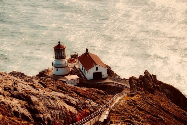
Point Reyes Lighthouse
A historic, picturesque lighthouse overlooking the Gulf of the Farallones. Popular place to take photos and for lighthouse lovers.
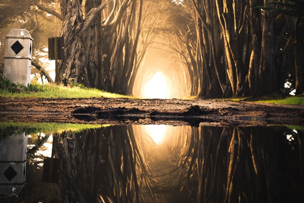
Cypress Tree Tunnel
A cool Game of Thrones style Historic tunnel made of Pine trees for that perfect Instagram shot.
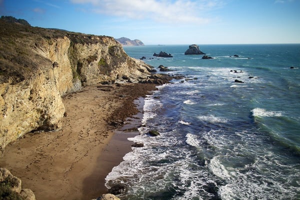
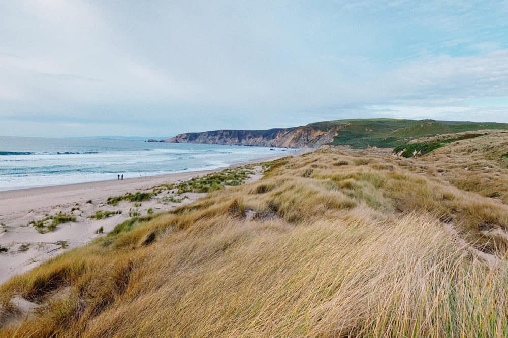
Limantour Beach
A huge wild beach setting for lots of recreational activities. It is dog friendly with possible whale viewing and body surfing.
Tomales Bay
A beautiful narrow inlet 15 miles long with an abundance of wildlife and hiking trails around it.
Drakes Beach
A popular protected beach to hang for a few hours with wonderful cliffs and Elephant Seal viewing.
Point Reyes Shipwreck
A historic landmark and fairly well preserved shipwreck. Popular location for photographers.
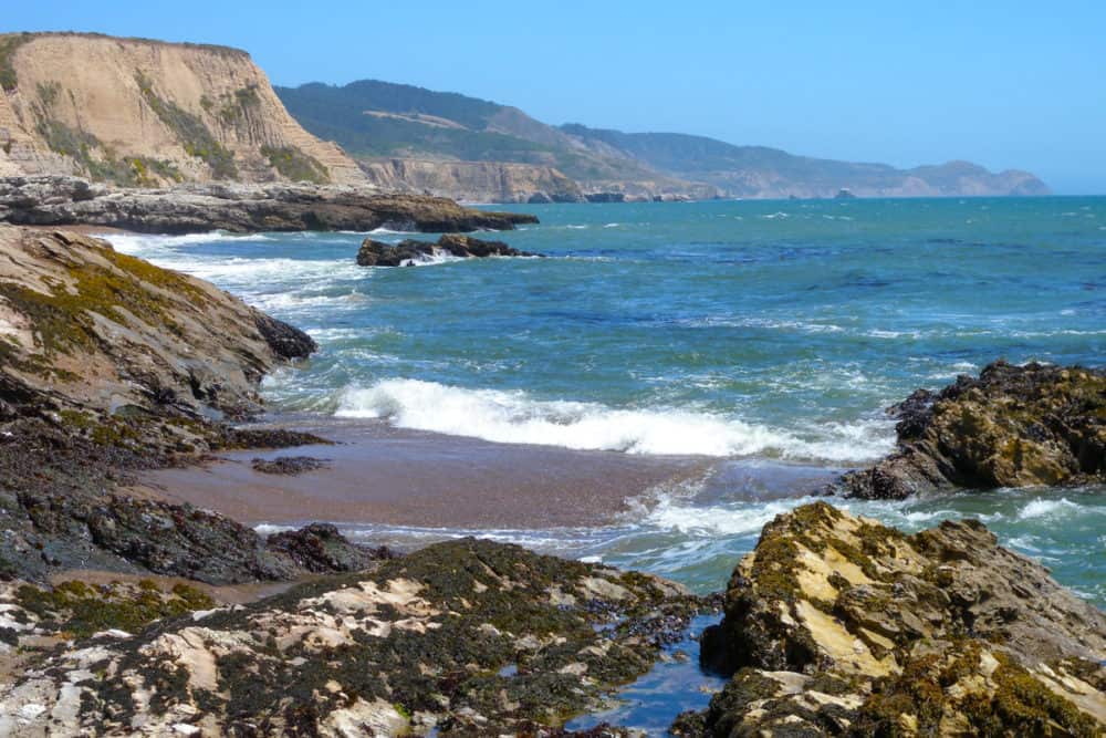
Chimney Rock
Chimney Rock is a small island off the tip of Point Reyes and is great for viewing whales.
Places to Stay when Hiking in Point Reyes
Point Reyes has some great accommodation options for those who plan to stay a few days to explore. They range from house rentals, Bnbs and Northern California glamping experiences. Here we have provided some of our favorite options on Airbnb.
Hikes in Point Reyes Map
10 Best Hikes in Point Reyes List
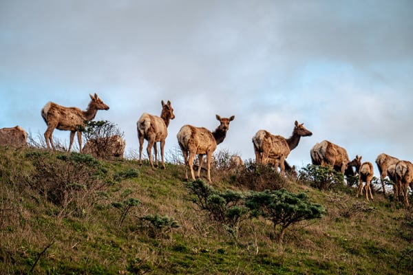
1) Tomales Point Trail

Length: 15.1 km
Elevation gain: 359m
Difficulty: Moderate
Summary
Tomales Point Trail is the most famous hiking trail among the hikers near Marshall, California. It is 15.1 kilometers moderate trafficked out and back that offers the opportunity to enjoy nature and wildlife’s amazing view. The Tomales Point Trail is mostly used for running, hiking, horses, walking, nature trips, and accessible year-round. At this trail, you can enjoy splendid views of Bodega Bay, Tomales Bay, and the Pacific Ocean. The Tomales Point Trail is remote, and in this reserve, the tule elk are enclosed.
The trail from the first 3 miles to the Lower Pierce Point Ranch is well maintained and marked for pedestrian convenience. Rather, the last stretch of the trail overgrown with shrubs and bush lupine, long sleeves, and long pants is a good idea. Tomales Point Trail’s journey offers worthy views; however, wind and fog can minimize the visibility. However, from Bear Valley, you can reach Tomales Point in a 40-minute driving time.
2) Chimney Rock Trail

Length: 3.1 km
Elevation gain: 82m
Difficulty: Easy
Summary
Chimney Rock Trail is located near Inverness, California, and 3.1 kilometers easily trafficked back and out. This hiking trail offers beautiful wild-flowers and other iconic views of nature. The Chimney Rock Trail is great for all levels of hikers and offers various activity options all over the year. The Chimney Rock Trail offers elephant sails at the beginning and offers a journey from the cliffs to the shores of a natural peninsula. The short mileage and ocean make Chimney Rock the most popular hiking point among the weekend crowd. Spring and winter are a great time to enjoy the movement of grey whales and Drake’s Bay. This trail has very few trees that make the hike blustery and foggy at a time, so packing according to the season.
3) Point Reyes Lighthouse Trail

Length: 2.1 km
Elevation gain: 101m
Difficulty: Moderate
Summary
Point Reyes Lighthouse is another most famous hiking trail, located near Inverness, California. Due to its beautiful wild-flower and moderate traffic, this trail is most popular among hikers, and it is accessible the whole-year for walking, nature trips, hiking, and bird watching. The length of this trail is 2.1 kilometers with easy to moderate out and back trail. The Point Reyes Lighthouse offers iconic views of Rugged California Coastline and Point Reyes Beach. According to the weather conditions, this hiking trail is open Friday to Monday from 2:30 pm to 4:00 pm.
4) Bear Valley Trail

Length: 13.1 km
Elevation gain: 734 feet
Difficulty: Easy/Moderate
Summary
Bear Valley Trail is the best hiking point for bikers, hikers, backpackers, equestrians, etc., located near Point Reyes Station, California. This valley trail is more popular and provides easy access to the coastline. This hike is a very popular trail and relatively flat, and a great way to explore Point Reyes. At the flat junction of Baldy Trail, Glen Trail, and Bear Valley Trail, a bike rack marks the boundary that shows here bike travel is not allowed. However, at this junction, the Bear Valley Trail ends with the Coast Trail, North. But most users also visit Arch Rock that is located near the Bear Valley.
5) Alamere Falls via Coast Trail from Palomarin Trailhead

Length: 19.6 km
Elevation gain: 899m
Difficulty: Heavy
Summary
This trail is located near Bolinas, California, and 19.6 kilometers of heavily out and back traffic. The trail is mostly used for nature trips, bird watching, and hiking, and open whole-year. The tidefall Alamere waterfall flows into the ocean in Point Reyes National Seashore. You can reach this popular Bay Area coastal hike from the Palomarin Trailhead.
You can access the parking area at the end of Mesa Road Outside of Bolinas. The Alamere Falls via Coast Trail offers a splendid view of the Pacific Ocean, Farallon Islands, Bass, and Pelican lakes. The National Park Service maintained the trail so you can visit the visitor centers for additional information. At the end of the trail, a little rock climbing included. However, it’s not easy to maintain to climb down to the National Park Service’s falls, so it is very dangerous. Make sure you wear perfect cloth and shoes according to the weather condition.
6) Kehoe Beach Trail
Length: 4.0 km
Elevation gain: 26m
Difficulty: Moderate
Summary
Kehoe beach trail is located near Inverness, California, and it has a 4.0 kilometer moderately trafficked. The trail offers a number of activities and is perfect for all levels of hikers and opens the whole year. The Kehoe Beach Trail is pet-friendly, so you can go with your lovely pet, but you must be kept on the leash. This 2.5-mile track offers incredible rock formations on the north side and a marsh on the south.
You can start your trail from the Kehoe Beach Trailhead toward the western ocean. The nearly flat dirt path parallels along with non-native mustard and sprinkles of California poppy. In this hike, you will enjoy the white-crowned sparrows singing and the wonderful beauty of nature.
7) Sunset Beach Trail and Estero Trail

Length: 12.1 km
Elevation gain: 269m
Difficulty: Moderate
Summary
The Sunset Beach Trail offers beautiful views of wild-flowers, located near Inverness, California, with a 12.1 kilometers length with moderately trafficked back and out of the trail. The beginning 1.1 miles of the trail meanders through an abandoned Christmas tree and grasslands farm. At this point, hikers reach a footbridge at the Estero outer limits. This bridge is a great location to enjoy bat rays, beautiful colorful birds, and leopard sharks in the water below. However, this is a perfect point for those who want to enjoy a shorter hike.
8) Muddy Hollow Trail

Length: 7.9 km
Elevation gain: 62m
Difficulty: Easy
Summary
Muddy Hollow Trail at Point Reyes, located near Inverness, California, with 7.9 kilometers length that offers a wide variety of hiking trails and splendid views of wild-flower zones. This hiking trail is easy to hike. At the start of the hike, a stream of woods-lined welcome the hikers by following the marsh, and then at Limantour Beach offers an oceanside view. A beautiful wide range of flowers such as Mimulus aurantiacus and bush monkey-flower go all the way with you. The trail starts with multiple trails, some head up to the estuary highlands and others back into the mountain and Limantour Beach. If you want to enjoy a shorter hike, you can turn back to the beach. This best hike in point Reyes is suitable for all skill levels and the whole year open.
9) Laguna-Coast Loop
Length: 9.7 km
Elevation gain: 153m
Difficulty: Easy/Moderate
Summary
Laguna-coast loop trail located near Point Reyes Station. It has 9.7 kilometers that offer an iconic view of a river and many other activities. Laguna-Coast Loop hiking is a great way to get a very beautiful view of diverse habitats that are located at the boundaries of Point Reyes National Seashore. The trail has vegetated dunes, open grassland, a lush valley, sensitive coastal bluffs, and a riparian zone. However, if you want to romp around in the sand, you need to reach the Coast Campground to see amazing Santa Maria Beach. The Laguna-Coast Loop is a trail that offers mild grades and plenty of scenic views.
10) Bolinas Ridge Trail

Length: 35 km
Elevation gain: 753m
Difficulty: Moderate
Summary
This trail offers amazing views of Olema Valley. It provides a open range feeling of expansiveness. You can choose to just do the first few miles if you’d like or you can continue on and explore some redwood forests and on through maritime chaparral. The trailhead is about 5 miles away from Bear Valley Visitor Center and starts on Sir Francis Drake Highway above Olema.
Conclusion
Point Reyes National Seashore, California, offers a wide range of hiking trails. In this article, we’ve discussed the top 10 best hikes in point Reyes National Seashore, California. So, if you plan to enjoy the amazing wildlife, wild-flowers, and beauty of nature, you can enjoy any of the above hiking trails and get your nature fix. Thanks for reading and see you out on the trails!
World Traveling Blogger, Social Media Expert and Nerd who has a passion for Adventure and Fitness.